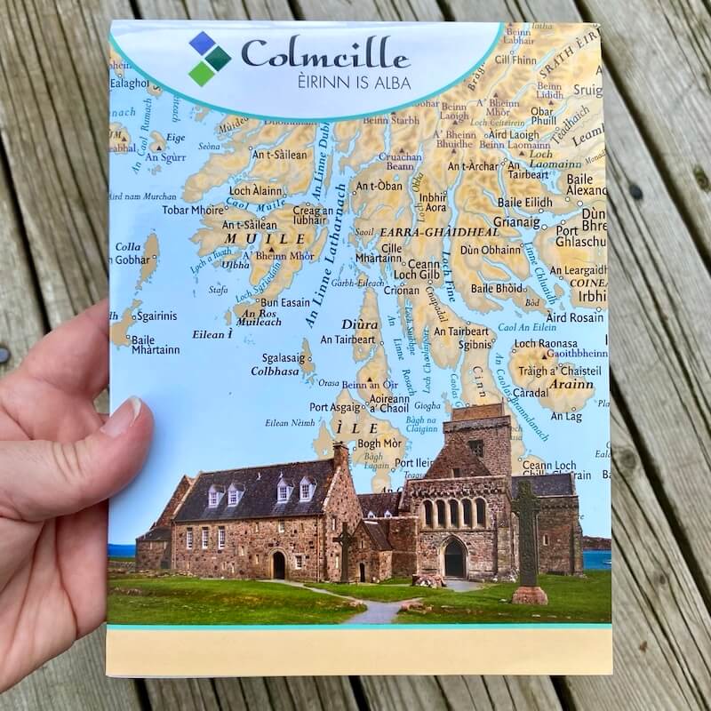
Map of Scotland & Ireland in Gaelic & Irish: St. Columba’s Land
$7.99
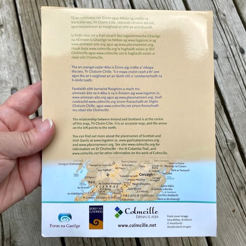
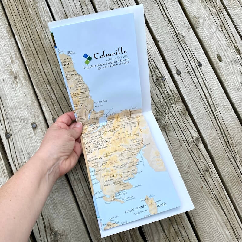
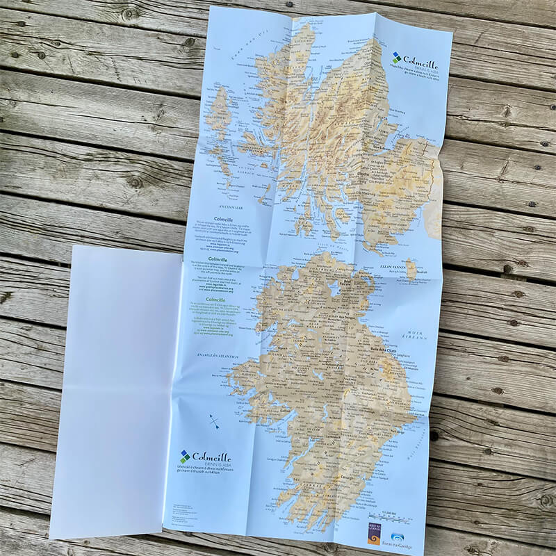
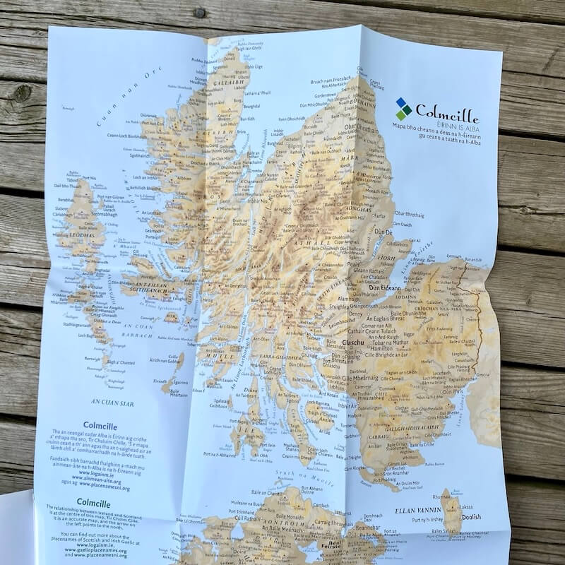
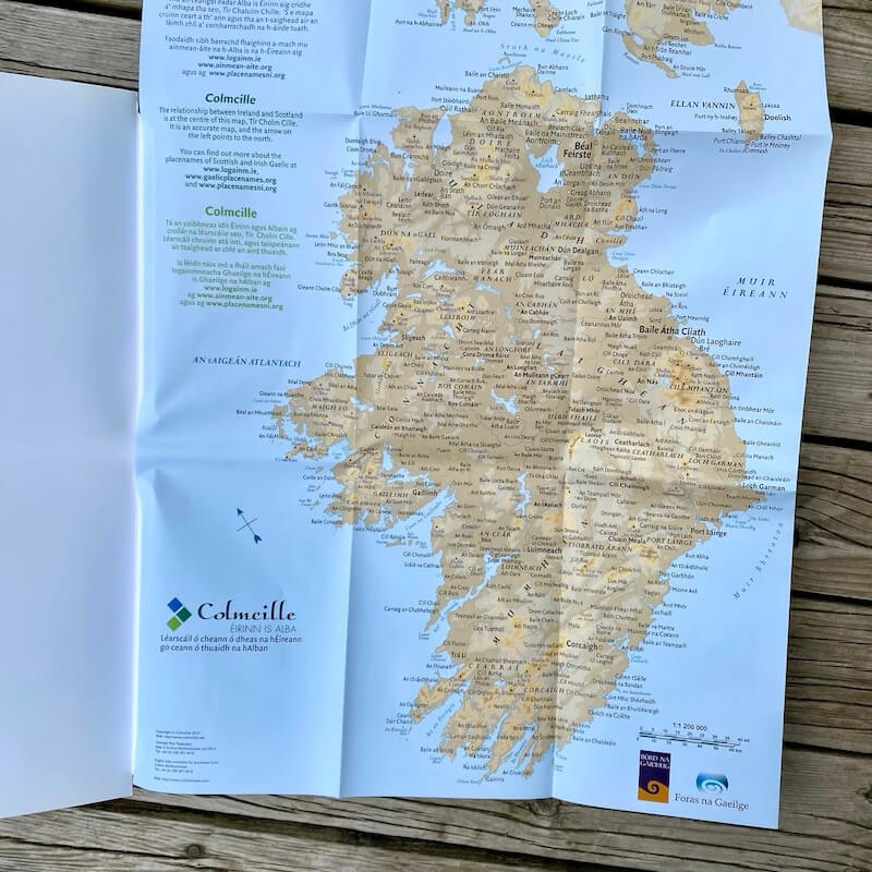
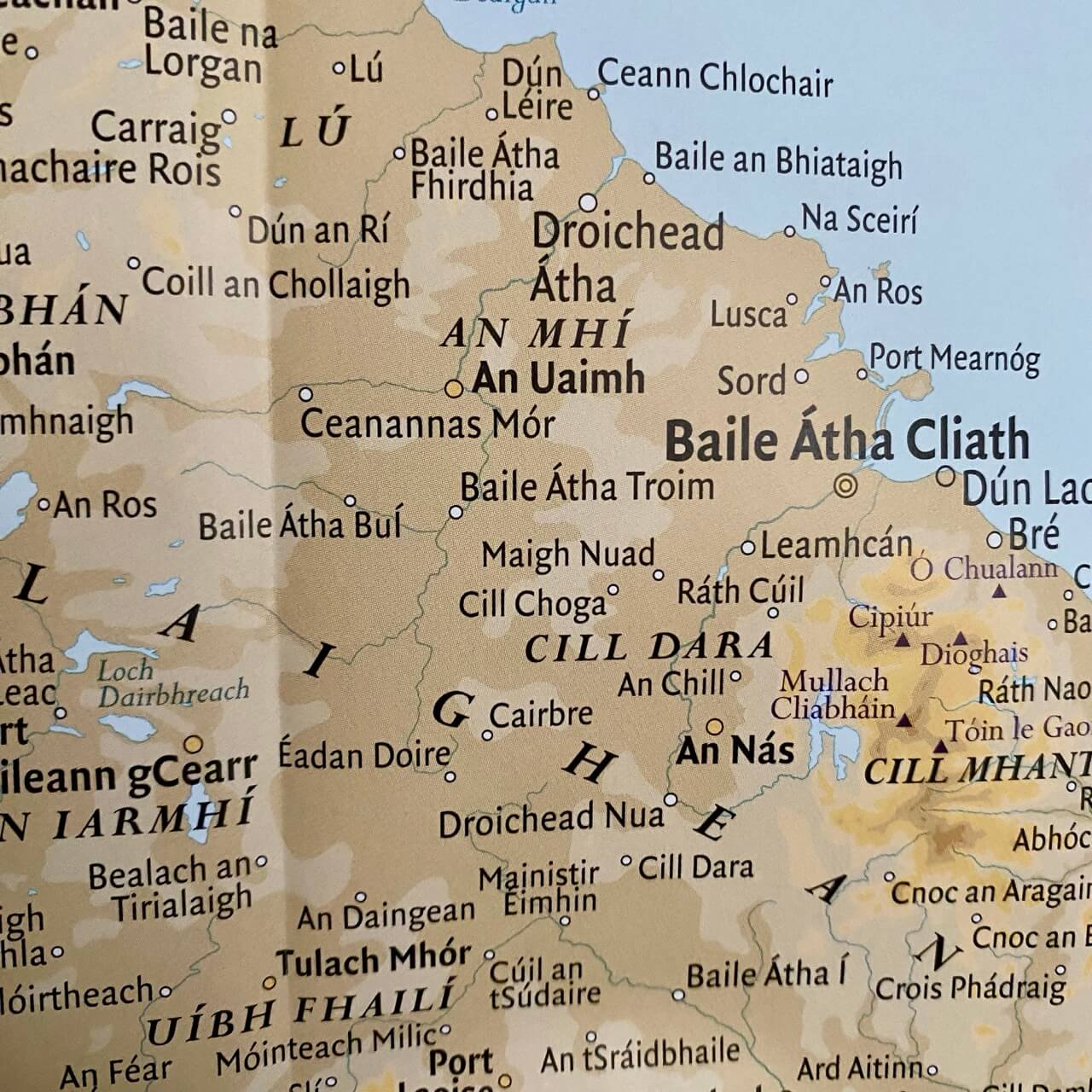
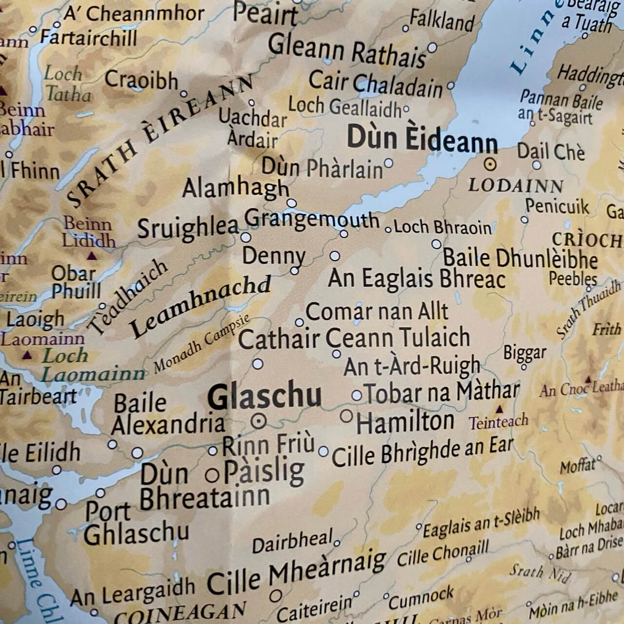
This map illustrates Scotland and Ireland as St. Columba’s Land (Tìr Chaluim Chille in Scottish Gaelic, or Tír Cholm Cille in Irish). The placenames in Scotland appear in Scottish Gaelic (Gàidhlig), while the placenames in Ireland appear in Irish (Gaeilge). This is a geographically accurate map with a different perspective, allowing the viewer to reorient to the concept of a Gaelic world. The arrow in the bottom left corner points to the north. Limited quantities available.
The map was originally created in 2012 for Colmcille, a partnership between Foras na Gaeilge in Ireland and Bòrd na Gàidhlig in Scotland. The partnership, named after St. Columba, was created to foster communication and collaboration between the Scottish Gaelic and Irish Gaelic language communities. Visit colmcille.net for more information.
Map Dimensions
Folded:
- 5.875 x 7.75 in
- 19.7 x 15 cm
Unfolded:
- 29.875 x 14.625 in
- 76 x 37 cm
Additional information
| Weight | .042 kg |
|---|---|
| Dimensions | 19.7 × 15 × .4 cm |